
Fort Garrison, Maryland

From time to time, I’ve written about local (often hidden) historical gems around Maryland. For this post, I wanted to add to this growing list with a building just a five-minute drive from our current home: Fort Garrison.
Fort Garrison is located on the north side of Garrison Farms Court, east of Stevenson Road and just a few minutes north of the Baltimore Beltway. Today, the fort is situated inside a quiet neighborhood northeast of Pikesville.

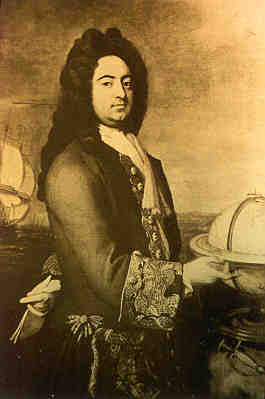
Francis Nicholson (1655-1728)
This building was erected in 1695 and served as the headquarters for a troop of mounted rangers appointed by Governor Francis Nicholson to patrol the Indian trails from the Patapsco to the Susquehanna in search of hostile parties and to protect both trade and settlers living in what was then the frontier and later acted as an outpost during the French and Indian Wars. Before arriving to the New World, Governor Nicholson (seen left) was a British military officer who was stationed throughout Europe and in parts of Africa. He served as lieutenant governor of Virginia, where he designed the layout of Williamsburg, and moved north to Maryland, later designing the town of Annapolis. In 1694, he was appointed governor of the colony of Maryland.
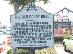
The commission of the rangers’ patrol of the area actually two decades before Nicholson’s tenure. In the late 1670s, a group of twenty soldiers were ordered to occasionally sweep the surrounding counties to protect frontier settlements against the Indian raids. As the road marker below shows, what is now Old Court Road was originally a well-established Indian trail that by the late seventeenth century was taken over by British Americans as a trade route.

The garrison itself was built around 1695. Its a rectangular structure measuring about 18 x 48 feet, with thick walls and a great fireplace remains and has gunports positioned on each side. The outpost was positioned on a tract of about 340 acres, and the patrol included trails that later became some of our more heavily-trafficked roads, including Rolling Road and Joppa Road.
It was called Oulton’s Garrison for its first commander, Captain John Oulton of Oldton. In one account the tract was described as the following:
This tract is described as follows: “Lying in Baltemore County on the north side of Patapsco River in the woods being pte (part) of the land called Rangers forest beginning at a bounded red oak standing on the east side of a glade by the Garrison and running thence north 20 degrees westerly 170 perches to a bounded white oak standing upon a point of a hill on the west side of a branch descending into Jones falls, and running from the said white oak west 20 degrees southerly 246 perches to a bounded white oak on the side of a hill and on the east side of a branch, then south 20 degrees easterly 222 perches to a bounded white oak standing by a glade called the West Glade (i. e. the Western Run of Jones Falls) then each 20 degrees northerly 246 perches, then with a direct line to the beginning.
In alternating weeks, half of the rangers would be on patrol, while the other half remained at the fort. Although records show that one ranger was murdered by Indians in 1696, life on the fort seemed relatively mundane. Boredom and the cold weather conditions during the winter seasons seemed to be the biggest difficulty soldiers faced. Discipline seemed laxed as in December 1696, Captain Oldton complained to his superiors that “three of his men deserted the Garrison & obstinately refuse to remain there all winter notwithstanding a former order therabout.” Amusingly today, to sweeten the deal, the governor offered a bonus of “ten dollars to drink the Kings Health with at Christmas.” In addition, some accounts show that another cabin was erected to house friendly Indians, who duties consisted of hunting for the soldiers and supplying them with game for during these months.
Over the next several decades, the fort changed hands several times, although duties remained essentially the same–if not a bit more slack during periods of transition. By the 1760s, the fort and much of the surrounding area was owned by John Risteau, High Sheriff of Baltimore County. About fourteen other families also lived nearby.
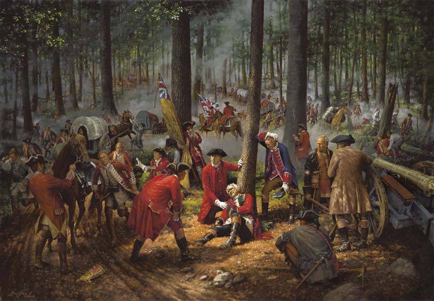
During the French and Indian War, just days after General Edward Braddock’s defeat at Fort Dusquesne (1755), Risteau cleared additional land and reestablished the fort and its patrol. Some accounts even note that locals carried rations and equipped themselves with weapons to church meetings, in case they were attacked on Sundays!
No such attack ever occurred, and, by the American Revolution just a couple of decades later, the fort fell into disuse. It survived, however, and in 1965 the property was acquired by the Baltimore County Department of Recreation and Parks. While it is listed on the National Register of Historic Places, the property remains buried in a suburban housing development today, a gem hidden in plain sight.


You must be logged in to post a comment.